
|
|
|
|
|
|
|
Kerri Urbaniak - Research |
|
|
Amy Covington - Drafting |
|
|
Danny Garrett - Drafting |
|
| cdg@brittain-crawford.com | |
|
Jeff Smith - Drafting |
|
| Jamie Schad- Admin. assistant | |
| admin@brittain-crawford.com | |
| webmaster: kg@brittain-crawford.com | |
| BC e-mail | BC e-mail manager |
| Last updated: 01/24/2026 by: KG | |
| copyrights ® Brittain & Crawford LLC | |
|
Get a survey quote: |
| Email us the property full address, with some additional information like: Lot and Block number, subdivision name, acreage of area to be surveyed, attach a map if available. Click to get the quote. |
|
List of contacts: |
|
James L. Brittain R.P.L.S. |
|
Stuart F. Smith R.P.L.S. |
|
|
| clb@brittain-crawford.com |
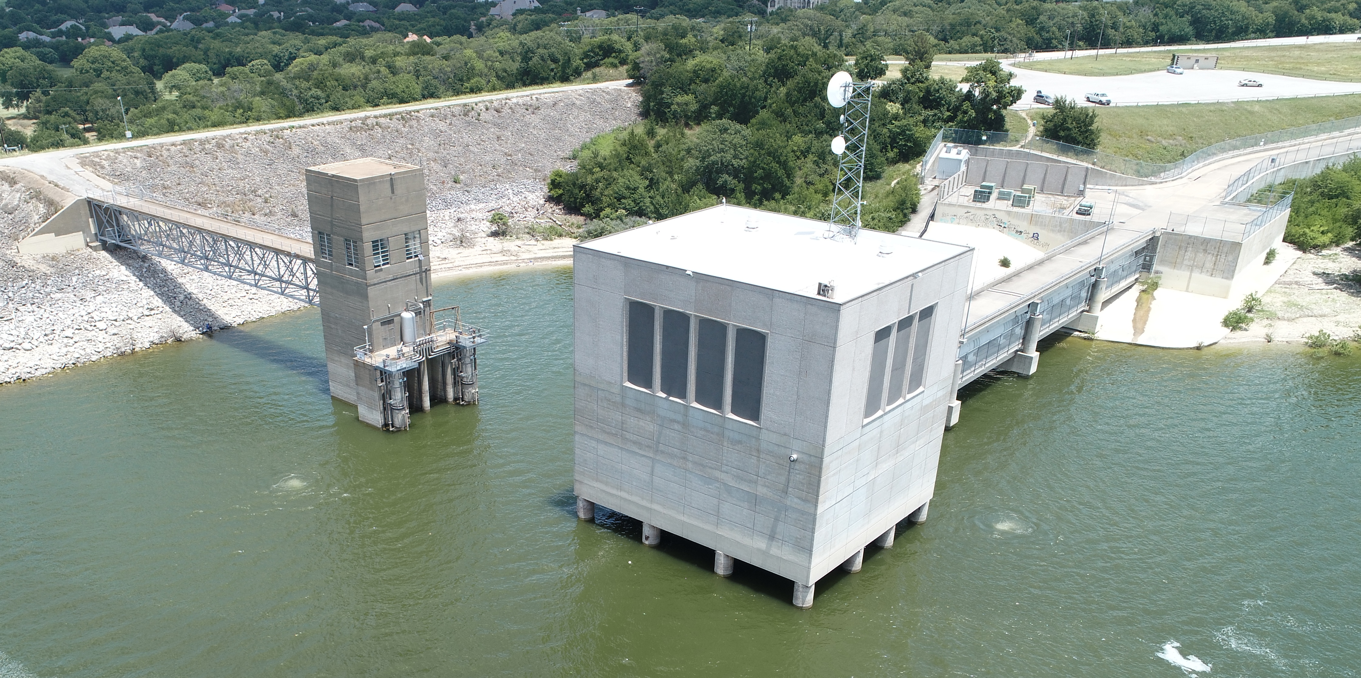
We now offer an aerial mapping using a DJI drone.
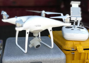
It is a perfect tool for any vertical structure, like bridge, building, water tower, transmission line tower etc., that would otherwise be difficult to survey using conventional methods. It is also a handy tool, when you don't want your employees to be at risk of injury in the high traffic areas, like busy intersections, or a highway. We have a full time licensed drone pilot, FAA certified.
 All
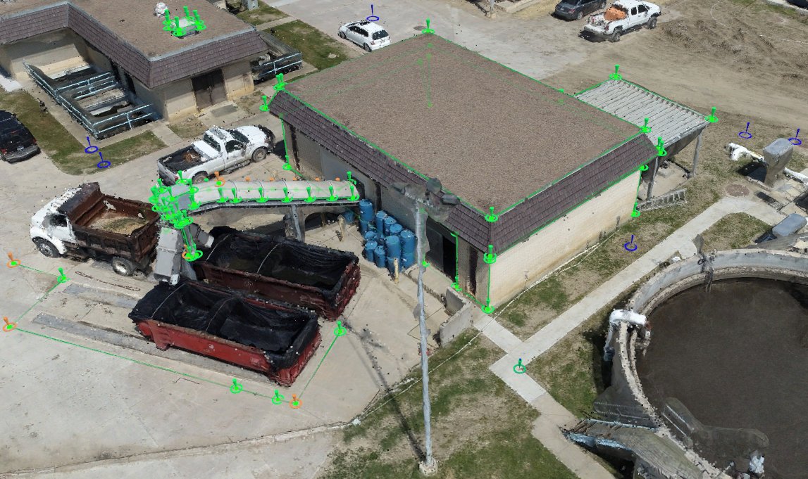
data can be captured by a drone, and with the support of the ground control,
using a post-processing software, it is transferred into a high density point
cloud, where each individual point has its own x,y,z, value, as shown on the
image below.
All
data can be captured by a drone, and with the support of the ground control,
using a post-processing software, it is transferred into a high density point
cloud, where each individual point has its own x,y,z, value, as shown on the
image below.
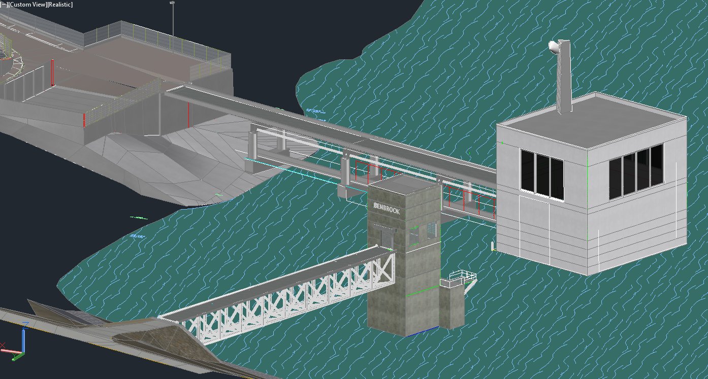
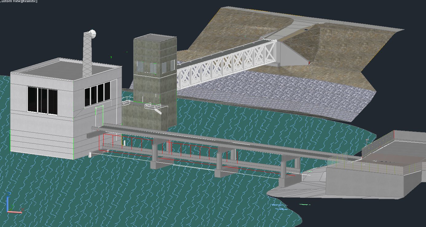
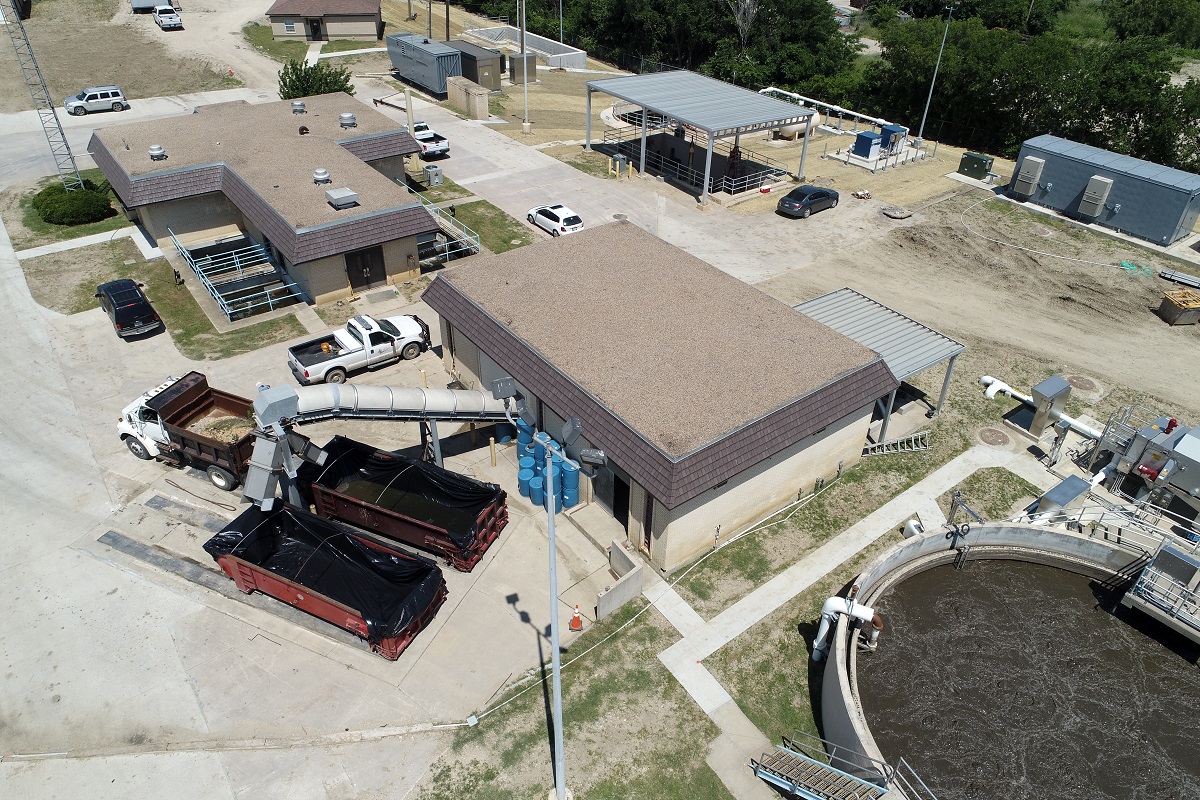
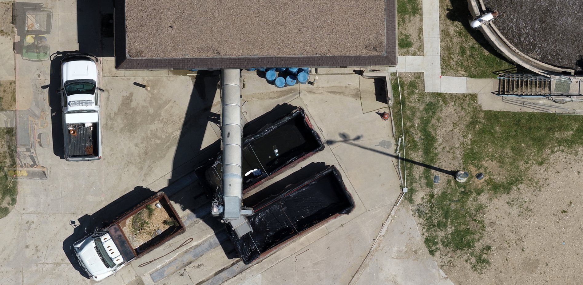
In this particular example of the water treatment plant in Texas, a series of 178 aerial images were taken, at the altitude of 120 feet above ground level. The low altitude has allowed us to achieve very high accuracy (mean RMS error = 0.038 ft), creating a point cloud of over 18 million points, of which each points has it's own X,Y,Z value.
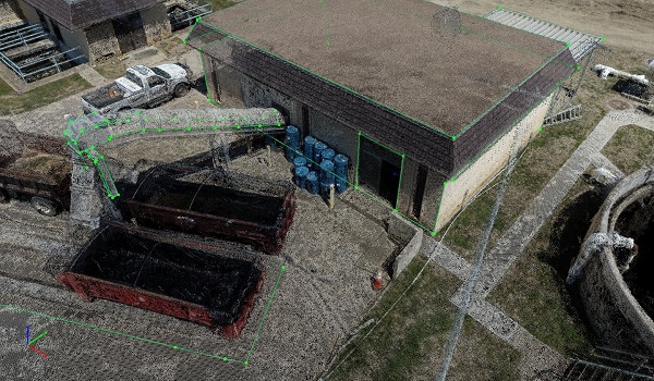
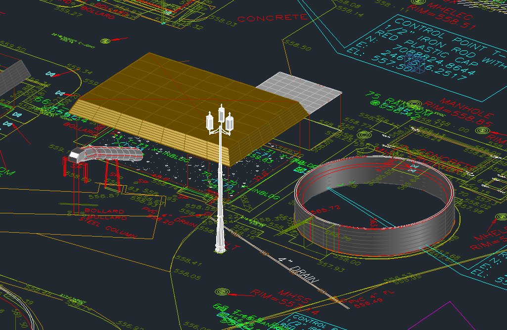
During post-processing, three dimensional line work is created, and exported to CAD.
Low altitude of the camera, allowed us to create a high resolution orthophoto image, where Average Ground Sampling Distance (GSD) is 1.12 cm / 0.44 in (pixel size), resulting in clear detail of the entire site.
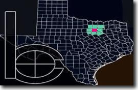
Surveying Lake Reservoir Control Section.
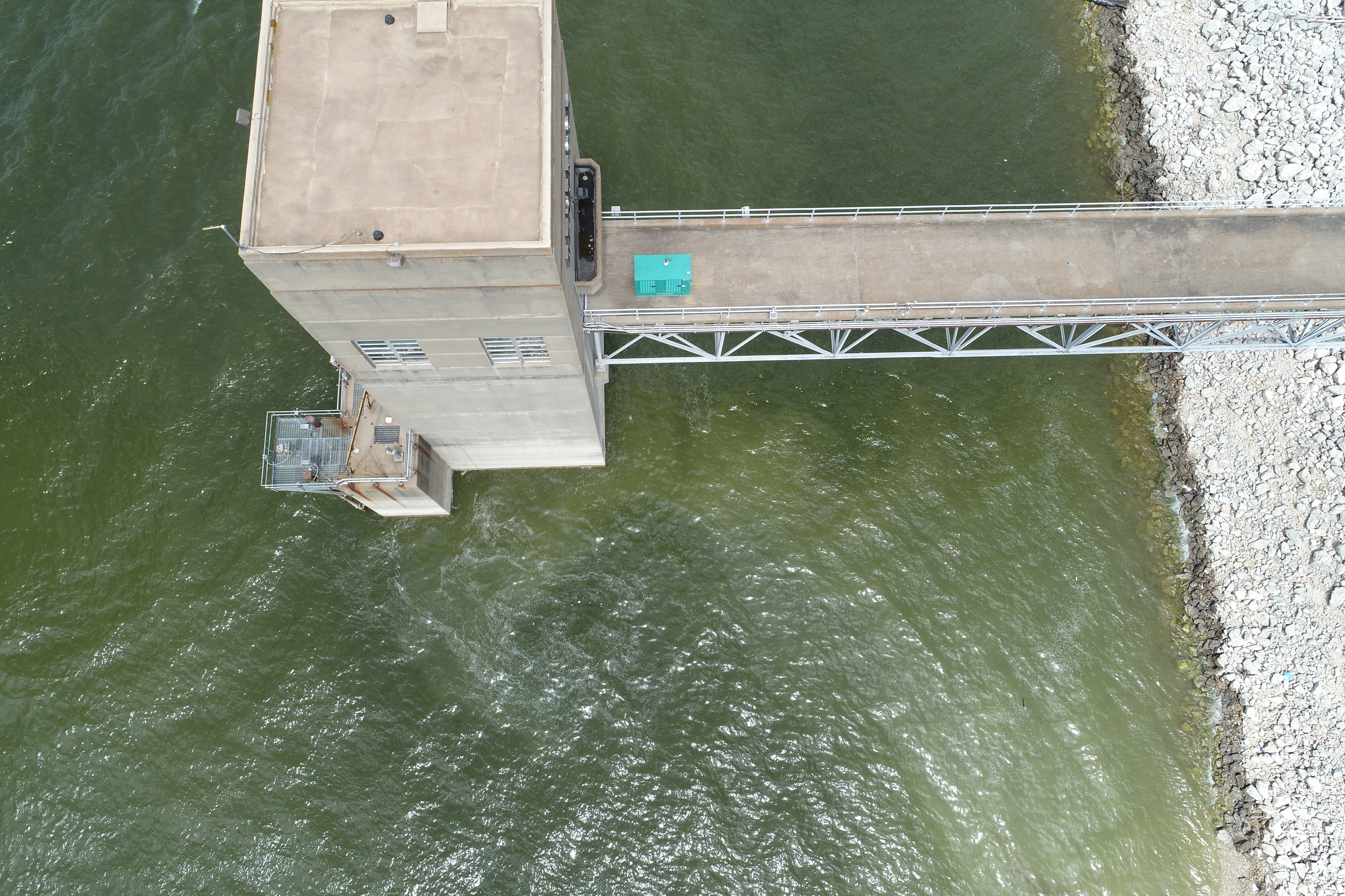
Aerial images captured using Dji drone
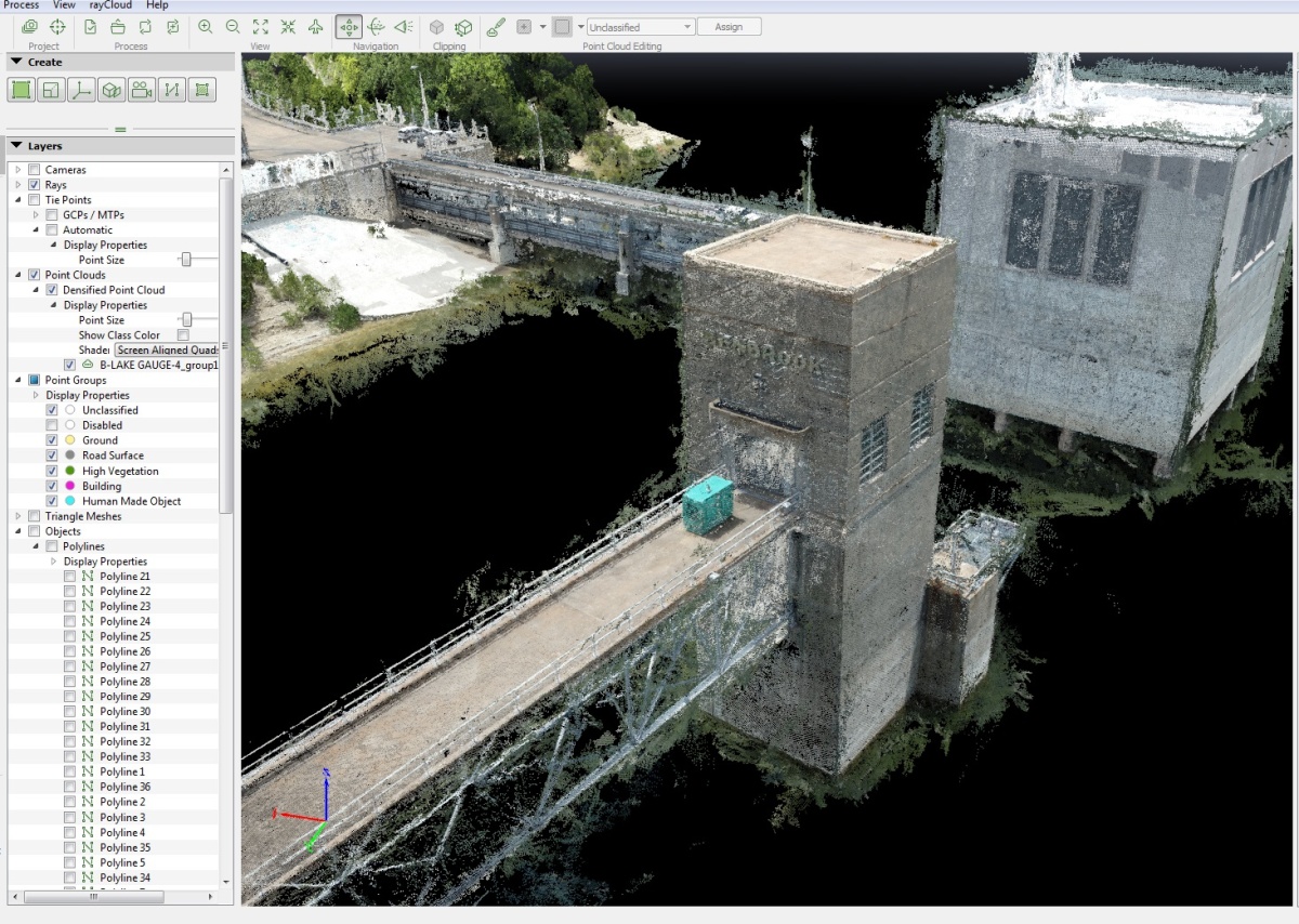
Point cloud based on the collected photographs.
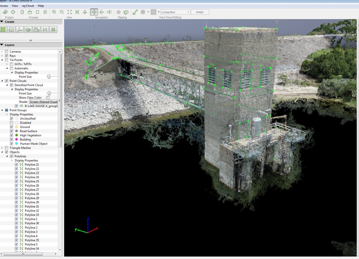
AutoCAD 3D renderings of the surveyed structures.